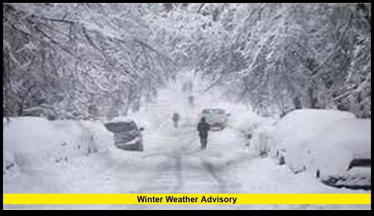
A winter weather advisory remains active across multiple U.S. regions as late-season February storms bring snow, ice, and dangerous travel conditions in 2026.
Across the United States, meteorological agencies continue issuing winter weather advisories when moderate winter hazards are expected. As of February 2026, several advisories affect parts of the Midwest, Northeast, Rocky Mountains, and Pacific Northwest due to recurring cold systems moving across the country. These alerts signal travel disruption risks, freezing rain, snow accumulation, and reduced visibility rather than extreme blizzard conditions.
What a Winter Weather Advisory Means in 2026
A winter weather advisory is issued when winter conditions can create inconvenience or hazards but do not meet warning-level severity. Officials emphasize caution because even moderate snow or ice leads to crashes, delays, and power issues.
Typical triggers for advisories include:
- Snow accumulation that affects travel
- Freezing rain producing slick roads
- Mixed precipitation events
- Wind-driven snow reducing visibility
- Rapid temperature drops causing flash freezing
These advisories often cover shorter time windows than winter storm warnings. However, impacts still affect daily routines, commuting, and school operations.
Where Winter Weather Advisories Are Active Right Now
As of February 19, 2026, winter weather advisories are frequently issued across several regions experiencing ongoing winter patterns.
Regions with recurring advisories in recent days:
- Midwest: Snow bands moving through states such as Minnesota, Wisconsin, Michigan, and Illinois.
- Northeast: Mixed precipitation events affecting New York, Pennsylvania, and New England.
- Rocky Mountains: Persistent mountain snow impacting Colorado, Wyoming, Utah, and Idaho.
- Pacific Northwest: Low-elevation snow and ice episodes affecting Washington and Oregon.
- Interior West: Cold air systems bringing light snow and freezing fog.
Meteorologists highlight that February typically delivers repeated advisory-level storms rather than single major events.
Forecast Pattern Driving Current Advisories
The winter weather pattern in 2026 shows a series of fast-moving disturbances crossing the United States. Cold Arctic air periodically drops south while Pacific moisture feeds snow and ice events.
Key forecast drivers include:
- Strong temperature contrasts across regions
- Jet stream dips bringing colder air south
- Moisture from Pacific storm systems
- Secondary low-pressure systems forming along frontal boundaries
This pattern creates frequent advisory situations instead of continuous severe storms.
Short-duration snow bursts and ice events are the main reason advisories remain common.
Expected Snow and Ice Impacts
Advisory-level storms still create measurable disruptions. Transportation remains the most affected sector.
Common impacts reported during winter weather advisory events:
- Slower highway travel and accidents
- Flight delays at major airports
- School schedule changes
- Transit delays in urban areas
- Increased demand for road treatment crews
Ice remains the most dangerous factor. Even light freezing rain can create widespread hazards.
Pacific Northwest Focus: Washington State Conditions
In Washington State, winter weather advisories continue to appear during cold air outbreaks and mountain snow events.
Recent advisory scenarios include:
- Low-elevation snow chances in western Washington
- Mountain pass snow affecting travel routes
- Overnight freezing temperatures causing icy roads
- Mixed precipitation near coastal areas
Mountain passes such as Snoqualmie and Stevens frequently see advisory-level snowfall. Commuters often experience chain requirements and delays.
Urban areas face risks when temperatures hover near freezing, allowing rain to turn icy quickly.
Midwest and Northeast Advisory Trends
The Midwest and Northeast remain the most consistently affected regions this winter.
Typical February advisory trends:
- Repeated clipper systems producing light snow
- Lake-effect snow creating localized impacts
- Ice events during temperature swings
- Snow squalls causing sudden visibility drops
Cities experience recurring travel disruptions rather than prolonged shutdowns. These patterns reflect a variable winter season with frequent moderate storms.
Difference Between Advisory, Watch, and Warning
Understanding alert levels helps readers respond appropriately.
| Alert Type | Meaning | Typical Impact |
|---|---|---|
| Winter Weather Advisory | Moderate hazards expected | Travel inconvenience |
| Winter Storm Watch | Potential significant storm | Prepare for disruption |
| Winter Storm Warning | Severe winter conditions occurring | Dangerous travel likely |
Advisories emphasize caution rather than emergency action.
Still, transportation officials stress that advisory conditions cause many winter crashes each year.
Travel Safety During a Winter Weather Advisory
Drivers face the highest risk during advisory events. Small changes in road conditions can create serious hazards.
Safety recommendations widely emphasized:
- Slow down and increase following distance
- Avoid sudden braking
- Check tire condition
- Carry winter emergency supplies
- Monitor local forecasts before traveling
Air travel also sees ripple effects. Even light snow can reduce airport efficiency.
Public transit agencies often operate slower schedules during advisory periods.
Infrastructure and Power Risk
Advisory-level storms rarely cause widespread outages, but localized problems still occur.
Possible infrastructure impacts:
- Tree branches breaking from wet snow
- Isolated power interruptions during ice events
- Water pipe freezing during temperature drops
- Increased road maintenance costs
Wet snow and freezing rain remain the main outage risks.
Utilities monitor advisory events closely because small ice accumulations can escalate quickly.
Climate and Seasonal Context for 2026 Winter Advisories
The 2025-2026 winter season shows a pattern of repeated moderate storms across the U.S.
Meteorological trends observed this season:
- Frequent temperature swings
- Increased mixed-precipitation events
- Regional snow variability
- Shorter but more frequent storm cycles
This pattern results in more winter weather advisories compared with fewer major blizzard events.
Late winter historically produces advisory-level storms as cold air interacts with incoming moisture.
How Long Winter Weather Advisories Typically Last
Most advisories last between 6 and 24 hours.
Duration depends on:
- Storm speed
- Temperature changes
- Precipitation type
- Terrain effects
Mountain regions often experience longer advisory periods due to persistent snow.
Urban areas usually see shorter windows focused on commute hours.
Public Response and Preparedness Trends
Public awareness around winter weather advisories has increased due to improved alerts and mobile notifications.
Recent preparedness trends include:
- Earlier commute planning
- Greater use of remote work during snow events
- Increased demand for winter tires
- Real-time travel monitoring through mobile apps
Officials emphasize that advisory alerts should not be ignored.
Many winter crashes occur during moderate storms because drivers underestimate conditions.
Outlook for Late February and Early March 2026
Seasonal forecasts suggest winter weather advisories will remain common into early March.
Expected pattern:
- Additional fast-moving snow systems
- Continued ice risk during temperature swings
- Mountain snow persisting in western states
- Gradual shift toward rain events in southern regions
Advisories typically continue even as spring approaches because overnight freezing remains possible.
Late-season storms often produce mixed precipitation, increasing advisory frequency.
Why Winter Weather Advisories Matter
A winter weather advisory signals real risk despite moderate severity. Travel, infrastructure, and daily routines can all be affected.
Key reasons these alerts matter:
- Most winter travel accidents occur in advisory conditions
- Ice events often begin as advisory-level situations
- Rapid temperature changes can worsen conditions quickly
- Localized storms create unexpected hazards
Ignoring advisories increases the chance of preventable incidents.
Understanding the alert helps people make safer decisions.
Conclusion
The winter weather advisory remains one of the most common winter alerts across the United States in 2026. Ongoing February storm patterns continue to produce snow, ice, and travel disruptions across multiple regions, including the Pacific Northwest, Midwest, Northeast, and mountain states. While these alerts signal moderate conditions, impacts can still be significant, especially during commuting hours and mixed precipitation events.
Stay alert to local conditions and share your experience with winter weather advisory impacts in your area to help others stay prepared.